 I know this area well, this is why I first recognised this anomaly. There is no trackway/ driveway, I'm sure. This map is from the "A to Z" series.
 On a detailed "Ordnance Survey" map, there is no such track! The only way that I can be completely sure is to go and see for myself....
 I walked up and down for ages. Double checked the position with my GPS. Nothing! These houses have been here for several decades, there were no dropped kerbs or anything to indicate the existence of a drive past or present. This track seems to be a complete fabrication by the map manufacturers.
 This second example took me longer to spot, as it is quite subtle. On the Ordnance survey map, again nothing amiss, apart from maybe the cliff could be marked a little more clearly as I've nearly tumbled off this more than once!
 Yet on another map, "Beacon Heights" mobile home park falsely appears on the East side of Pinfold Lane, not the West. This 'mistake' isn't due to limitations of presentation, as there is plenty of space to display the details correctly. These 'mistakes' are far too obvious to be genuine and are repeated on each map edition after edition. Looks like I'll have to check this one out too....
 This is Barr Beacon. It is the nearest place to park. It is a great high ridge (barr), where warning beacons used to be lit, hence Barr Beacon. This bandstand houses one of Britain's many Ordnance Survey triangulation points, and can be seen as a distinctive landmark for miles around.
 There are great views from here. You can see Birmingham, Walsall, the hills of the 'Black' country, on a clear day even the Malvern hills. During the day is pleasant, but at night it is spectacular. Apparently, looking north east, the next highest point is the Ural mountains in Russia, although I would take this so called fact with a 'pinch of salt' as I've never researched this. It might be one of those frequently bandied facts such as Birmingham having more miles of canals than Venice, I just don't know!
 From here I walked down the hillside to the old section of Bridle Lane, abandoned as a road due to its steepness (photos never do justice to inclination) some forty years ago.
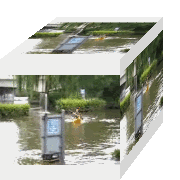
 This skirted round the base of the cliffs. The sign says "DANGER, unstable cliff face", fair enough, but to read it you have to get so close that you're standing right underneath the "unstable cliff face"!
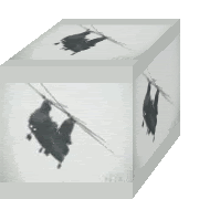
 Eventually I got to Pinfold Lane. This view looking south, clearly indicates the mobile home park is on the west side of the lane!
Conclusion.... I believe that these anomalies are 'ghosts' introduced into the map datum in order to reveal unauthorised duplication and therefore maintain copyright. A bit of a bummer if you're trying to find Beacon Heights mobile home park though!
I would like to know, is this purely a British phenomenon, or is this technique used worldwide? Comments gratefully received...
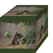
 On return to the car, I encountered this fenced off area on the top of the barr. The sign reads "Barr Beacon Beeches. Planted by Sir Joseph Scott, Bart, of Great Barr Hall, circa 1799".
It looked familiar....
 These railings have been replaced, the previous ones having been vandalised and bent. Although over ten years ago, I'm sure one day the culprit will be caught.....you know who you are!!!

1 comment:
I don't know about mistakes on locals maps here, as I never have used them much. I may have to look into that.
Thanks for posting all the cool photos!
Post a Comment